


Meubon
Corneal Topographer – Surface Curvature Mapping for Eye Labs & Optometry Clinics | Ophthalmic Corneal Analysis System
In stock
Corneal Topographer – Surface Curvature Analysis System for Ophthalmic Labs, Optometry & Ophthalmology
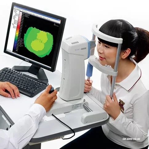
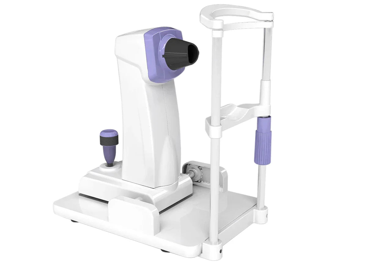
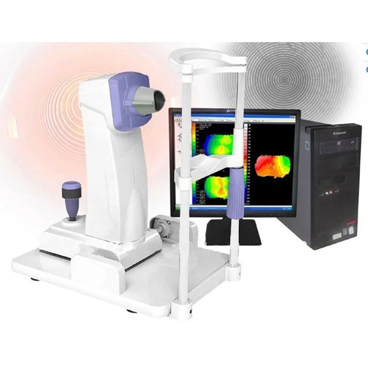
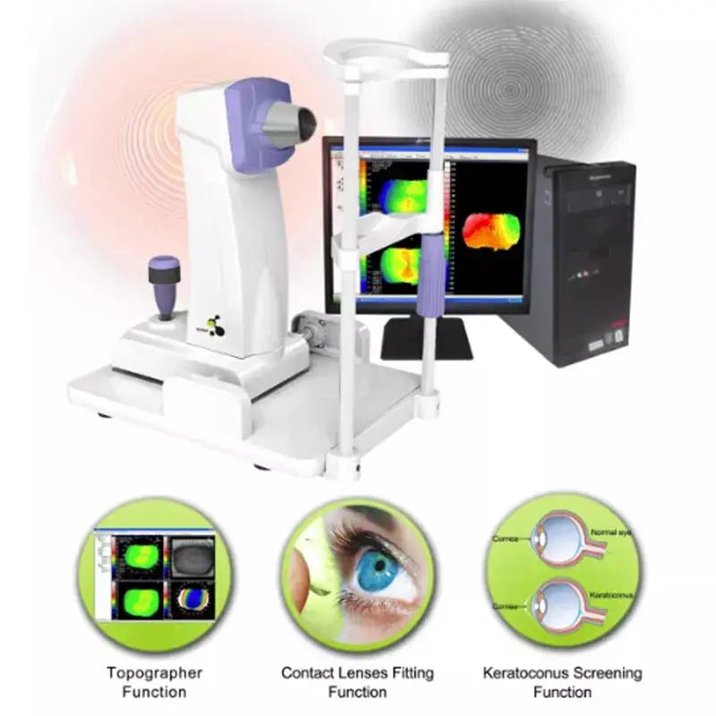
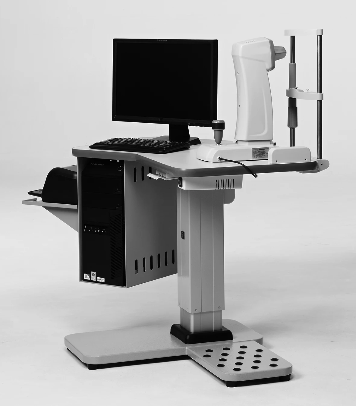
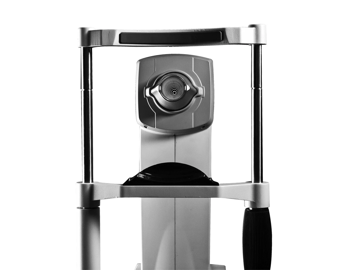
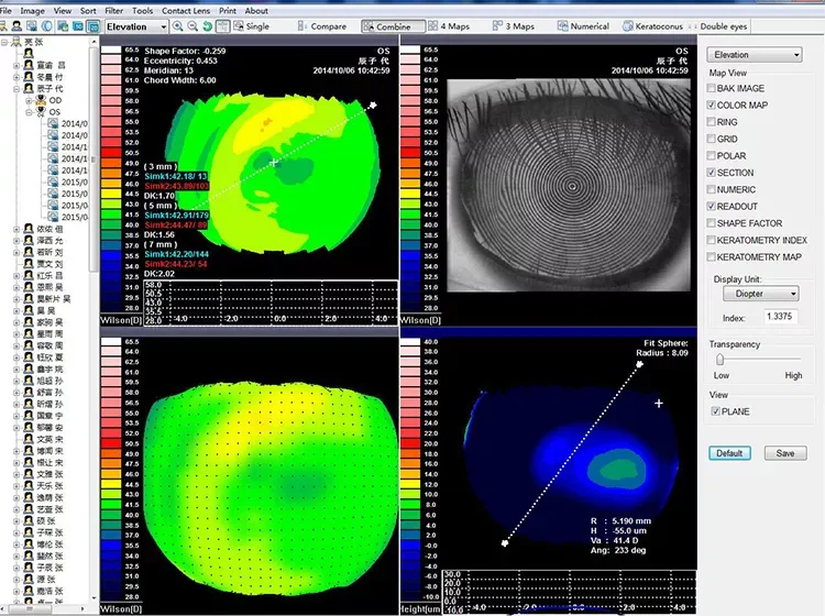
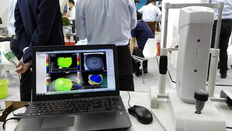
The Corneal Topographer is a high-precision diagnostic device designed for detailed mapping and analysis of the corneal surface curvature. Utilizing PLACIDO cone technology with 31 rings and 7,936 measurement points, this system delivers comprehensive visualizations that support clinical decision-making in ophthalmology, optometry, and refractive surgery.
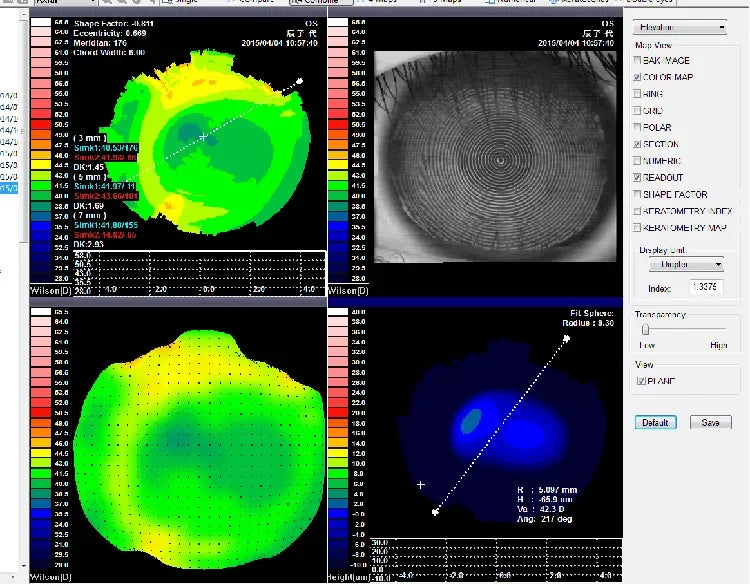
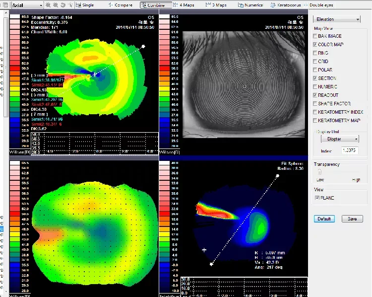
Ideal for preoperative evaluation, postoperative outcome analysis, and contact lens fitting, the system provides a range of detailed maps including axial curvature, tangential curvature, elevation, 3D topography, and simulated keratoscope imaging.


🔍 Key Features:
-
Measurement Mode: PLACIDO Cone Technology
-
Measurement Coverage: Diameter up to 10.91 mm
-
Curvature Radius Range: 5.5 mm – 10.0 mm (33.75D – 61.36D)
-
Measurement Precision: ±0.02 mm
-
Placido Rings: 31 precision-calibrated rings
-
Total Measurement Points: 7,936 for detailed mapping
-
Map Display Options:
-
Axial Curvature Map
-
Tangential Curvature Map
-
Elevation Map
-
Simulated Keratoscope Map
-
3D Corneal Topography Map
-
-
Output: High-resolution color inkjet printer
-
Adjustable Range:
-
Left/Right: >86 mm
-
Forward/Backward: >40 mm
-
Up/Down: >30 mm
-
Chinrest: >50 mm
-
👁️ Advanced Clinical Capabilities:
-
Contact Lens Fitting Guidance: Improve accuracy in adaptive lens selection
-
Keratoconus Detection Function: Early identification and analysis of corneal irregularities
-
Surgical Support: Pre- and post-operative assessments for corneal refractive surgeries
Applications:
Perfect for ophthalmology clinics, optometry practices, eye hospitals, and research labs, this corneal analyzer ensures reliable diagnostics, accurate surgical planning, and optimized patient care.
Unlock precision in corneal surface mapping with this advanced topography system.